d-maps > United States of America (USA) > South Dakota > South Dakota > boundaries, counties, white

South Dakota
State of South Dakota

boundaries
counties
white
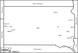
South Dakota : counties
Aurora, Beadle, Bennett, Bon Homme, Brookings, Brown, Brule, Buffalo, Butte, Campbell, Charles Mix, Clark, Clay, Codington, Corson, Custer, Davison, Day, Deuel, Dewey, Douglas, Edmunds, Fall River, Faulk, Grant, Gregory, Haakon, Hamlin, Hand, Hanson, Harding, Hughes, Hutchinson, Hyde, Jackson, Jerauld, Jones, Kingsbury, Lake, Lawrence, Lincoln, Lyman, Marshall, McCook, McPherson, Meade, Mellette, Miner, Minnehaha, Moody, Pennington, Perkins, Potter, Roberts, Sanborn, Oglala Lakota, Spink, Stanley, Sully, Todd, Tripp, Turner, Union, Walworth, Yankton, Ziebach.
| About | Terms and conditions of use | Guest book | Privacy Policy 
© 2007-2026 https://d-maps.com